Audio Tour
Las Vegas to Grand Canyon Village
279miles
29stops
4h20m
Listen — all 29 stops free
1
Vegas to the Grand Canyon by Road
Mile 0
You're heading from Las Vegas to Grand Canyon Village — about 280 miles and a little over four hours of driving.
0:00
2
Railroad Pass and Nevada's Oldest Gaming License
Mile 21 — Boulder City
You're passing through Railroad Pass, a natural gap between the River Mountains to the north and the McCullough Range to the south.
0:00
3
Purple Heart Highway Through the Desert
Mile 26
This stretch of road you're on carries the designation Purple Heart Highway, named in honor of combat-wounded veterans.
0:00
4
Boulder City: Nevada's Gambling-Free Town
Mile 32 — -114.79871
Boulder City was built from scratch in 1931 as a federal reservation to house the thousands of workers constructing Hoover Dam. The U.S.
0:00
5
Old Highway 93 Switchbacks Below
Mile 35 — Boulder City
Before the Mike O'Callaghan–Pat Tillman Memorial Bridge opened in 2010, every vehicle on US-93 had to descend into Black Canyon on a road carved directly into the cliff…
0:00
6
Mike O'Callaghan–Pat Tillman Memorial Bridge
Mile 37 — Willow Beach
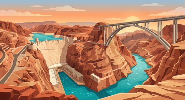
You crossed the highest concrete arch bridge in the Western Hemisphere back near Hoover Dam, but here's what most people don't know about its construction.
0:00
7
Willow Beach Below Hoover Dam
Mile 37 — Willow Beach
You're near Willow Beach, one of the few access points to the Colorado River directly downstream of Hoover Dam.
0:00
8
Lake Mead's Shifting Shoreline and White Bathtub Ring
Mile 45
You're driving along the western arm of Lake Mead, and if you can catch a glimpse of the water, notice the stark white band on the surrounding rock faces.
0:00
9
Temple Bar and Ancient Volcanic Tuff
Mile 54 — Willow Beach
The turnoff near here leads to Temple Bar, one of Lake Mead's most isolated access points.
0:00
10
White Hills and the Joshua Tree Belt
Mile 64
You're passing through White Hills, named for a short-lived silver mining district that boomed in 1892 and collapsed within a few years.
0:00
11
Dolan Springs and Off-Grid Desert Living
Mile 73 — Dolan Springs
Dolan Springs is one of dozens of unincorporated communities scattered across northwestern Arizona where many residents live entirely off the grid — no municipal water,…
0:00
12
Golden Valley and the Sacramento Valley Basin
Mile 89
You're crossing Golden Valley, a basin squeezed between the Cerbat Mountains to the west and the Hualapai Mountains to the south.
0:00
13
Santa Fe Railway Built This Town
Mile 106 — Kingman
The Atchison, Topeka and Santa Fe Railway didn't just pass through Kingman — it created it.
0:00
14
Kingman and Andy Devine's Hometown Legacy
Mile 106 — Kingman
You're passing through Kingman, where Andy Devine grew up.
0:00
15
Hualapai Mountains: Sky Island Above the Desert
Mile 111 — Kingman
Those peaks rising south of I-40 are the Hualapai Mountains, a sky island that climbs from roughly 3,300 feet at the desert floor to 8,417 feet at Hualapai Peak.
0:00
16
The Long Climb from Basin to Plateau
Mile 145
You're driving through one of the most dramatic elevation transitions in the American West right now.
0:00
17
Crossing onto the Colorado Plateau at Seligman
Mile 178 — Seligman
Right about here, you're crossing one of the most significant geological boundaries in North America.
0:00
18
Seligman and the Route 66 Revival
Mile 178 — Seligman
In 1987, a barber in this small town changed American highway preservation forever.
0:00
19
Juniper Grasslands of the Plateau Transition
Mile 190
This stretch of I-40 between Ash Fork and Williams sits in what ecologists call the juniper-grassland transition zone, roughly five thousand to six thousand feet in…
0:00
20
Ash Fork: Flagstone Capital of the World
Mile 201 — Ash Fork
Ash Fork has shipped more flagstone than any town in the country.
0:00
21
Williams: Gateway Town Since the 1880s
Mile 208
Williams was the last town on Route 66 to be bypassed by Interstate 40, holding out until October 1984.
0:00
22
Bill Williams Mountain and Its Alpine Survivors
Mile 216 — Williams
Bill Williams Mountain, the prominent peak south of town, is named for one of the most eccentric figures in frontier history.
0:00
23
Grand Canyon Railway Depot in Williams
Mile 219 — Williams
The Grand Canyon Railway began service in 1901, meaning tourists reached the South Rim by train nearly three decades before most Americans owned cars.
0:00
24
Driving on the Grand Canyon Rim Rock
Mile 220 — Williams
The pale roadcuts you can see along the highway here expose Kaibab Limestone, the exact same rock layer that forms the rim of the Grand Canyon.
0:00
25
Ranching History on the Coconino Plateau
Mile 235
This stretch of Highway 64 crosses the Coconino Plateau, one of the largest open grasslands in northern Arizona.
0:00
26
Valle Aircraft Collection on Open Plateau
Mile 249 — Williams
Valle is home to one of the more unexpected roadside attractions in Arizona — a private outdoor collection of roughly thirty military and civilian aircraft parked in the…
0:00
27
Ranching the Coconino Plateau for Generations
Mile 259
This stretch of Highway 64 crosses the Coconino Plateau, one of the largest grazing regions in northern Arizona.
0:00
28
Ponderosa Pine Forest at Seven Thousand Feet
Mile 269 — Grand Canyon Village
The Ponderosa pines surrounding you right now are the most widely distributed pine species in North America, ranging from British Columbia to Mexico.
0:00
29
Karst Sinkhole on the Kaibab Plateau
Mile 269 — Grand Canyon Village
That shallow dry lake bed you may notice alongside the highway sits inside a solution sinkhole, a depression formed when slightly acidic rainwater dissolved the Kaibab…
0:00
iOS · Works offline · Hands-free
Listen — all 29 stops free
1
Vegas to the Grand Canyon by Road
Mile 0
You're heading from Las Vegas to Grand Canyon Village — about 280 miles and a little over four hours of driving.
0:00
2
Railroad Pass and Nevada's Oldest Gaming License
Mile 21 — Boulder City
You're passing through Railroad Pass, a natural gap between the River Mountains to the north and the McCullough Range to the south.
0:00
3
Purple Heart Highway Through the Desert
Mile 26
This stretch of road you're on carries the designation Purple Heart Highway, named in honor of combat-wounded veterans.
0:00
4
Boulder City: Nevada's Gambling-Free Town
Mile 32 — -114.79871
Boulder City was built from scratch in 1931 as a federal reservation to house the thousands of workers constructing Hoover Dam. The U.S.
0:00
5
Old Highway 93 Switchbacks Below
Mile 35 — Boulder City
Before the Mike O'Callaghan–Pat Tillman Memorial Bridge opened in 2010, every vehicle on US-93 had to descend into Black Canyon on a road carved directly into the cliff…
0:00
6
Mike O'Callaghan–Pat Tillman Memorial Bridge
Mile 37 — Willow Beach
You crossed the highest concrete arch bridge in the Western Hemisphere back near Hoover Dam, but here's what most people don't know about its construction.
0:00
7
Willow Beach Below Hoover Dam
Mile 37 — Willow Beach
You're near Willow Beach, one of the few access points to the Colorado River directly downstream of Hoover Dam.
0:00
8
Lake Mead's Shifting Shoreline and White Bathtub Ring
Mile 45
You're driving along the western arm of Lake Mead, and if you can catch a glimpse of the water, notice the stark white band on the surrounding rock faces.
0:00
9
Temple Bar and Ancient Volcanic Tuff
Mile 54 — Willow Beach
The turnoff near here leads to Temple Bar, one of Lake Mead's most isolated access points.
0:00
10
White Hills and the Joshua Tree Belt
Mile 64
You're passing through White Hills, named for a short-lived silver mining district that boomed in 1892 and collapsed within a few years.
0:00
11
Dolan Springs and Off-Grid Desert Living
Mile 73 — Dolan Springs
Dolan Springs is one of dozens of unincorporated communities scattered across northwestern Arizona where many residents live entirely off the grid — no municipal water,…
0:00
12
Golden Valley and the Sacramento Valley Basin
Mile 89
You're crossing Golden Valley, a basin squeezed between the Cerbat Mountains to the west and the Hualapai Mountains to the south.
0:00
13
Santa Fe Railway Built This Town
Mile 106 — Kingman
The Atchison, Topeka and Santa Fe Railway didn't just pass through Kingman — it created it.
0:00
14
Kingman and Andy Devine's Hometown Legacy
Mile 106 — Kingman
You're passing through Kingman, where Andy Devine grew up.
0:00
15
Hualapai Mountains: Sky Island Above the Desert
Mile 111 — Kingman
Those peaks rising south of I-40 are the Hualapai Mountains, a sky island that climbs from roughly 3,300 feet at the desert floor to 8,417 feet at Hualapai Peak.
0:00
16
The Long Climb from Basin to Plateau
Mile 145
You're driving through one of the most dramatic elevation transitions in the American West right now.
0:00
17
Crossing onto the Colorado Plateau at Seligman
Mile 178 — Seligman
Right about here, you're crossing one of the most significant geological boundaries in North America.
0:00
18
Seligman and the Route 66 Revival
Mile 178 — Seligman
In 1987, a barber in this small town changed American highway preservation forever.
0:00
19
Juniper Grasslands of the Plateau Transition
Mile 190
This stretch of I-40 between Ash Fork and Williams sits in what ecologists call the juniper-grassland transition zone, roughly five thousand to six thousand feet in…
0:00
20
Ash Fork: Flagstone Capital of the World
Mile 201 — Ash Fork
Ash Fork has shipped more flagstone than any town in the country.
0:00
21
Williams: Gateway Town Since the 1880s
Mile 208
Williams was the last town on Route 66 to be bypassed by Interstate 40, holding out until October 1984.
0:00
22
Bill Williams Mountain and Its Alpine Survivors
Mile 216 — Williams
Bill Williams Mountain, the prominent peak south of town, is named for one of the most eccentric figures in frontier history.
0:00
23
Grand Canyon Railway Depot in Williams
Mile 219 — Williams
The Grand Canyon Railway began service in 1901, meaning tourists reached the South Rim by train nearly three decades before most Americans owned cars.
0:00
24
Driving on the Grand Canyon Rim Rock
Mile 220 — Williams
The pale roadcuts you can see along the highway here expose Kaibab Limestone, the exact same rock layer that forms the rim of the Grand Canyon.
0:00
25
Ranching History on the Coconino Plateau
Mile 235
This stretch of Highway 64 crosses the Coconino Plateau, one of the largest open grasslands in northern Arizona.
0:00
26
Valle Aircraft Collection on Open Plateau
Mile 249 — Williams
Valle is home to one of the more unexpected roadside attractions in Arizona — a private outdoor collection of roughly thirty military and civilian aircraft parked in the…
0:00
27
Ranching the Coconino Plateau for Generations
Mile 259
This stretch of Highway 64 crosses the Coconino Plateau, one of the largest grazing regions in northern Arizona.
0:00
28
Ponderosa Pine Forest at Seven Thousand Feet
Mile 269 — Grand Canyon Village
The Ponderosa pines surrounding you right now are the most widely distributed pine species in North America, ranging from British Columbia to Mexico.
0:00
29
Karst Sinkhole on the Kaibab Plateau
Mile 269 — Grand Canyon Village
That shallow dry lake bed you may notice alongside the highway sits inside a solution sinkhole, a depression formed when slightly acidic rainwater dissolved the Kaibab…
0:00