Audio Tour
Cody, WY to Yellowstone
80miles
16stops
1h50m
Listen — all 16 stops free
1
Heart Mountain's Impossible Journey
Mile 0 — Cody
That flat-topped peak visible to the northeast is Heart Mountain, and it represents one of geology's most debated mysteries.
0:00
2
Buffalo Bill Center of the West
Mile 1 — Cody
The sprawling complex you can see as you leave Cody is the Buffalo Bill Center of the West, often called the Smithsonian of the West.
0:00
3
The Bighorn Basin Floor You're Crossing
Mile 9
You're driving across the Bighorn Basin, one of the driest spots in Wyoming, averaging under ten inches of rain a year.
0:00
4
Chief Joseph's Flight Begins Here
Mile 17 — Cody
This junction marks the start of the Chief Joseph Scenic Byway, named for the Nez Perce leader who led roughly 750 men, women, and children on a desperate…
0:00
5
Absaroka Range Ancient Volcanic Origins
Mile 18 — Cody
The jagged peaks dominating the skyline are remnants of the Absaroka volcanic field, one of the largest in North American history.
0:00
6
Ranching at Seven Thousand Feet Elevation
Mile 23
You're driving through some of the most remote ranch country in the lower forty-eight states.
0:00
7
Switchbacks Down Into Sunlight Basin
Mile 29 — Cody
You're now navigating one of the most demanding stretches of highway in Wyoming.
0:00
8
Sunlight Basin's Hidden Ranching History
Mile 34
Sunlight Basin is one of the most isolated inhabited valleys in the lower forty-eight states. For decades, ranchers here had no road access at all.
0:00
9
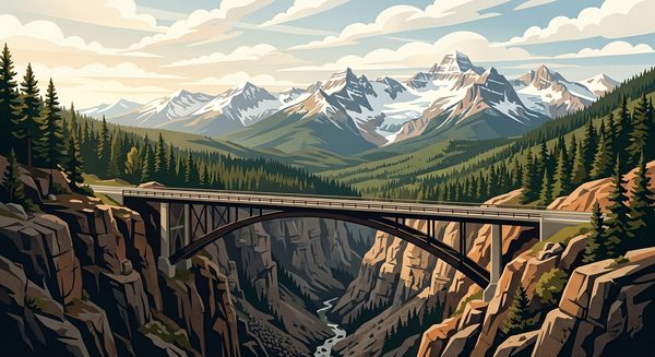
Wyoming's Highest Bridge Over Sunlight Creek
Mile 39 — Cody
You're crossing the Sunlight Bridge, the highest bridge in Wyoming at 280 feet above Sunlight Creek.
0:00
10
Dead Indian Pass and Its Dark Name
Mile 44 — Cody
You're at Dead Indian Pass, elevation eight thousand sixty feet.
0:00
11
The Clarks Fork of the Yellowstone
Mile 44 — Cody
The river cutting through this valley is the Clarks Fork of the Yellowstone, named by William Clark in 1806 based on information from Native guides, though Clark himself…
0:00
12
The Corridor Between Two Mountain Ranges
Mile 57
You're driving through one of Wyoming's narrowest ecological corridors, a strip of land squeezed between the Absaroka Range to the south and the Beartooth Plateau to the…
0:00
13
Where the Beartooth Highway Begins
Mile 70 — Cody
You're approaching the junction where Wyoming 296 meets US 212, the start of the Beartooth Highway.
0:00
14
Cooke City: Trapped by Geography Since 1870
Mile 75 — Cooke City
Cooke City exists because of gold, discovered here in 1870, but the town's real story is isolation. For over a century, this community has been essentially landlocked.
0:00
15
Silver Gate: Yellowstone's Smallest Gateway Town
Mile 78 — Silver Gate
Silver Gate was purpose-built in the 1930s as a tourist service point, and the entire town was constructed with a unified rustic log architecture style that local…
0:00
16
Yellowstone's Northeast Entrance and Lamar Valley
Mile 79 — Gardiner
You're arriving at the least-used of Yellowstone's five entrances, which means you've chosen the route most visitors skip entirely.
0:00
iOS · Works offline · Hands-free
Listen — all 16 stops free
1
Heart Mountain's Impossible Journey
Mile 0 — Cody
That flat-topped peak visible to the northeast is Heart Mountain, and it represents one of geology's most debated mysteries.
0:00
2
Buffalo Bill Center of the West
Mile 1 — Cody
The sprawling complex you can see as you leave Cody is the Buffalo Bill Center of the West, often called the Smithsonian of the West.
0:00
3
The Bighorn Basin Floor You're Crossing
Mile 9
You're driving across the Bighorn Basin, one of the driest spots in Wyoming, averaging under ten inches of rain a year.
0:00
4
Chief Joseph's Flight Begins Here
Mile 17 — Cody
This junction marks the start of the Chief Joseph Scenic Byway, named for the Nez Perce leader who led roughly 750 men, women, and children on a desperate…
0:00
5
Absaroka Range Ancient Volcanic Origins
Mile 18 — Cody
The jagged peaks dominating the skyline are remnants of the Absaroka volcanic field, one of the largest in North American history.
0:00
6
Ranching at Seven Thousand Feet Elevation
Mile 23
You're driving through some of the most remote ranch country in the lower forty-eight states.
0:00
7
Switchbacks Down Into Sunlight Basin
Mile 29 — Cody
You're now navigating one of the most demanding stretches of highway in Wyoming.
0:00
8
Sunlight Basin's Hidden Ranching History
Mile 34
Sunlight Basin is one of the most isolated inhabited valleys in the lower forty-eight states. For decades, ranchers here had no road access at all.
0:00
9
Wyoming's Highest Bridge Over Sunlight Creek
Mile 39 — Cody
You're crossing the Sunlight Bridge, the highest bridge in Wyoming at 280 feet above Sunlight Creek.
0:00
10
Dead Indian Pass and Its Dark Name
Mile 44 — Cody
You're at Dead Indian Pass, elevation eight thousand sixty feet.
0:00
11
The Clarks Fork of the Yellowstone
Mile 44 — Cody
The river cutting through this valley is the Clarks Fork of the Yellowstone, named by William Clark in 1806 based on information from Native guides, though Clark himself…
0:00
12
The Corridor Between Two Mountain Ranges
Mile 57
You're driving through one of Wyoming's narrowest ecological corridors, a strip of land squeezed between the Absaroka Range to the south and the Beartooth Plateau to the…
0:00
13
Where the Beartooth Highway Begins
Mile 70 — Cody
You're approaching the junction where Wyoming 296 meets US 212, the start of the Beartooth Highway.
0:00
14
Cooke City: Trapped by Geography Since 1870
Mile 75 — Cooke City
Cooke City exists because of gold, discovered here in 1870, but the town's real story is isolation. For over a century, this community has been essentially landlocked.
0:00
15
Silver Gate: Yellowstone's Smallest Gateway Town
Mile 78 — Silver Gate
Silver Gate was purpose-built in the 1930s as a tourist service point, and the entire town was constructed with a unified rustic log architecture style that local…
0:00
16
Yellowstone's Northeast Entrance and Lamar Valley
Mile 79 — Gardiner
You're arriving at the least-used of Yellowstone's five entrances, which means you've chosen the route most visitors skip entirely.
0:00