Audio Tour
Astoria, OR to Brookings, OR
337miles
44stops
7h14m
Listen — all 44 stops free
1
Astoria Column on Coxcomb Hill
Mile 0 — Astoria
Look up toward the hilltop and you should spot the Astoria Column, a 125-foot concrete tower standing on Coxcomb Hill at about 600 feet elevation.
0:00
2
Astoria-Megler Bridge Across the Columbia
Mile 1 — Astoria
That bridge spanning the Columbia River ahead of you is the Astoria-Megler Bridge, the longest continuous truss bridge in North America at four point one miles.
0:00
3
Fort Clatsop and a Miserable Winter
Mile 5 — Warrenton
The Corps of Discovery spent the winter of 1805 to 1806 just east of here at Fort Clatsop, and by every account it was awful.
0:00
4
Fort Stevens and the Japanese Attack
Mile 5 — Warrenton
In June 1942, a Japanese submarine surfaced offshore and fired seventeen shells at Fort Stevens, making it the only mainland American military installation attacked…
0:00
5
Clatsop Plains Between Fort and Seaside
Mile 10
You're crossing the Clatsop Plains right now, one of the flattest stretches on the entire Oregon coast.
0:00
6
Seaside's Golf Course Predates Most Western Courses
Mile 15 — Seaside
You're passing through one of Oregon's oldest planned beach resorts. Seaside's golf course, established in 1892, is among the oldest west of the Mississippi River.
0:00
7
Lewis and Clark's Salt Works at Seaside
Mile 17 — Seaside
The Corps of Discovery needed salt badly. By January 1806, their stockpile was gone, and unseasoned elk meat was demoralizing the group wintering at Fort Clatsop.
0:00
8
The Cannon That Named a Town
Mile 19 — Seaside
The town of Cannon Beach gets its name from a literal piece of naval wreckage. In 1846, the USS Shark, a U.S. Navy schooner, broke apart crossing the Columbia River bar.
0:00
9
Cannon Beach and Its Iconic Sea Stack
Mile 23 — Cannon Beach
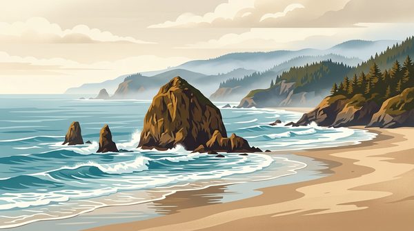
You're entering Cannon Beach, home to Haystack Rock, a 235-foot basalt sea stack that's one of the most recognizable landmarks on the entire Pacific coast.
0:00
10
Arch Cape Tunnel Through Ancient Lava
Mile 30 — Arch Cape
You're about to pass through the Arch Cape Tunnel, a roughly 500-foot bore blasted straight through a basalt headland in 1940.
0:00
11
Oswald West and Oregon's Public Beaches
Mile 33 — Nehalem
You're passing near Oswald West State Park, named for the governor who made one of the most consequential land decisions in American history.
0:00
12
Nehalem River and the Lost Galleon
Mile 39 — 35015 N Hwy 101
You're crossing the Nehalem River estuary, where one of the Pacific Northwest's great maritime mysteries played out over centuries.
0:00
13
Tillamook Burns Reshaped This Forest
Mile 46 — Nehalem
Between 1933 and 1951, four massive wildfires swept through these mountains, collectively known as the Tillamook Burns.
0:00
14
Tillamook Bay and Its Oyster Legacy
Mile 53
You're approaching Tillamook Bay, one of the largest estuaries on the Oregon coast, covering roughly sixteen hundred acres of tidal flats.
0:00
15
Tillamook Cheese Capital of Oregon
Mile 60 — Tillamook
Tillamook's cheese cooperative started in 1909 when local dairy farmers pooled resources to standardize their product and reach distant markets.
0:00
16
Tillamook's Giant WWII Blimp Hangar
Mile 63 — Tillamook
Coming up is Hangar B, one of the largest clear-span wooden structures ever built.
0:00
17
Nestucca River Valley Dairy Country
Mile 73
You're driving through the Nestucca River valley right now, one of the smaller coastal watersheds that helped build Oregon's dairy industry long before Tillamook became…
0:00
18
Pacific City and Its Giant Dune
Mile 84 — Cloverdale
You're approaching Pacific City, a small unincorporated community best known for Cape Kiwanda, a sandstone headland where local dory fishermen launch flat-bottomed boats…
0:00
19
Nestucca Valley Dairy Country to Coast
Mile 90
You're driving through the Nestucca River valley, one of the most productive small watersheds on the Oregon coast.
0:00
20
Cascade Head Biosphere Reserve Prairie
Mile 97 — Otis
Cascade Head is one of only three UNESCO Biosphere Reserves in Oregon, designated in 1980.
0:00
21
Lincoln City and the World's Shortest River
Mile 102 — Lincoln City
Lincoln City didn't exist before 1965.
0:00
22
Siletz Bay and a Forced Confederation
Mile 104 — Lincoln City
The water you're passing now is Siletz Bay, the tidal outlet of the Siletz River. What makes the Siletz story distinct is scale.
0:00
23
The Tilted Terraces of the Oregon Coast
Mile 109
The flat bench you're driving across right now is a marine terrace, an ancient seafloor pushed above the waterline by tectonic forces.
0:00
24
Depoe Bay's Tiny Harbor and Spouting Horns
Mile 114 — Depoe Bay
Depoe Bay's harbor is just six acres, often called the world's smallest navigable harbor.
0:00
25
Cape Foulweather Named by Captain Cook
Mile 115 — Depoe Bay
Captain James Cook named this headland Cape Foulweather on March 7, 1778, making it the first point on the Oregon Coast recorded by a European explorer.
0:00
26
Devils Punchbowl and Its Violent Tides
Mile 118 — Newport
The rock formation near this stretch of highway is Devils Punchbowl, a massive hollowed-out bowl carved from sandstone by the Pacific Ocean.
0:00
27
Yaquina Head and Its Ancient Lava Flow
Mile 123 — Newport
The basalt headland coming into view is Yaquina Head, and its origin story is remarkable.
0:00
28
Newport Oregon Historic Bayfront Fishing Port
Mile 126 — Newport
You're entering Newport, the economic hub of the central Oregon coast and home to the largest commercial fishing fleet in the state.
0:00
29
Yaquina Bay Bridge Art Deco Marvel
Mile 127 — Newport
The bridge you're crossing right now was designed by Conde McCullough, Oregon's master bridge engineer, and completed in 1936.
0:00
30
OSU Hatfield Marine Science Center
Mile 127 — Newport
Oregon State University's Hatfield Marine Science Center here in Newport is where scientists first documented the Cascadia Subduction Zone's threat to this coastline.
0:00
31
The Marine Terraces of South Beach
Mile 131
The flat ground you're driving across right now is a marine terrace, an ancient seafloor lifted above the waves by tectonic forces.
0:00
32
Seal Rock's Volcanic Remnants and Pinnipeds
Mile 136 — Seal Rock
The rocky outcrops you can see offshore here are not eroded pieces of the coastline. They're the opposite — they're harder than the coast.
0:00
33
Waldport's WWII Conscientious Objector Camp
Mile 141 — Waldport
During World War Two, a Civilian Public Service camp operated right here in Waldport, housing conscientious objectors — men who refused military service on moral or…
0:00
34
Alsea Bay and the Tidewater Zone
Mile 145
You're crossing the Alsea Bay estuary right now, one of the most productive tidal systems on the Oregon coast.
0:00
35
Yachats: The Gem of the Oregon Coast
Mile 149 — Yachats
You're entering Yachats, a village of about seven hundred people that the Alsea people called their home for thousands of years.
0:00
36
The Siuslaw River and Its Estuary
Mile 156
You're crossing the Siuslaw River estuary right now, and this waterway has a history most Oregon rivers don't.
0:00
37
Heceta Head and Lost Galleon Treasure
Mile 162 — Afghanistan
You're rounding Heceta Head, one of the most photographed headlands on the Oregon coast, rising over sixteen hundred feet above the Pacific.
0:00
38
The Siuslaw River Country Below You
Mile 168
You're crossing into the territory of the Siuslaw people, whose name gives us both the river and the national forest surrounding you.
0:00
39
Florence and the Oregon Dunes Gateway
Mile 173 — Florence
You're entering Florence, a town that sits at the northern edge of the Oregon Dunes National Recreation Area — the largest expanse of coastal sand dunes in North…
0:00
40
Winchester Bay and the Umpqua Estuary
Mile 196
Winchester Bay sits at the mouth of the Umpqua River, one of Oregon's most productive estuaries and a major migration corridor for Chinook salmon, coho, and striped bass.
0:00
41
Coos Bay, Oregon's Largest Coastal City
Mile 218 — Coos Bay
You're entering Coos Bay, the largest city on the Oregon coast, with a population around ten thousand.
0:00
42
Coquille River Valley Dairy Country
Mile 230
The Coquille River you're following here drains a watershed of nearly seven hundred square miles, one of the largest on the southern Oregon coast.
0:00
43
Bandon: The Town That Burned Twice
Mile 242 — Bandon
You're entering Bandon, a town that was nearly wiped off the map twice by fire.
0:00
44
The Rogue River Meets the Pacific
Mile 281
You're approaching the mouth of the Rogue River, one of the original eight rivers in America designated as Wild and Scenic back in 1968.
0:00
iOS · Works offline · Hands-free
Listen — all 44 stops free
1
Astoria Column on Coxcomb Hill
Mile 0 — Astoria
Look up toward the hilltop and you should spot the Astoria Column, a 125-foot concrete tower standing on Coxcomb Hill at about 600 feet elevation.
0:00
2
Astoria-Megler Bridge Across the Columbia
Mile 1 — Astoria
That bridge spanning the Columbia River ahead of you is the Astoria-Megler Bridge, the longest continuous truss bridge in North America at four point one miles.
0:00
3
Fort Clatsop and a Miserable Winter
Mile 5 — Warrenton
The Corps of Discovery spent the winter of 1805 to 1806 just east of here at Fort Clatsop, and by every account it was awful.
0:00
4
Fort Stevens and the Japanese Attack
Mile 5 — Warrenton
In June 1942, a Japanese submarine surfaced offshore and fired seventeen shells at Fort Stevens, making it the only mainland American military installation attacked…
0:00
5
Clatsop Plains Between Fort and Seaside
Mile 10
You're crossing the Clatsop Plains right now, one of the flattest stretches on the entire Oregon coast.
0:00
6
Seaside's Golf Course Predates Most Western Courses
Mile 15 — Seaside
You're passing through one of Oregon's oldest planned beach resorts. Seaside's golf course, established in 1892, is among the oldest west of the Mississippi River.
0:00
7
Lewis and Clark's Salt Works at Seaside
Mile 17 — Seaside
The Corps of Discovery needed salt badly. By January 1806, their stockpile was gone, and unseasoned elk meat was demoralizing the group wintering at Fort Clatsop.
0:00
8
The Cannon That Named a Town
Mile 19 — Seaside
The town of Cannon Beach gets its name from a literal piece of naval wreckage. In 1846, the USS Shark, a U.S. Navy schooner, broke apart crossing the Columbia River bar.
0:00
9
Cannon Beach and Its Iconic Sea Stack
Mile 23 — Cannon Beach
You're entering Cannon Beach, home to Haystack Rock, a 235-foot basalt sea stack that's one of the most recognizable landmarks on the entire Pacific coast.
0:00
10
Arch Cape Tunnel Through Ancient Lava
Mile 30 — Arch Cape
You're about to pass through the Arch Cape Tunnel, a roughly 500-foot bore blasted straight through a basalt headland in 1940.
0:00
11
Oswald West and Oregon's Public Beaches
Mile 33 — Nehalem
You're passing near Oswald West State Park, named for the governor who made one of the most consequential land decisions in American history.
0:00
12
Nehalem River and the Lost Galleon
Mile 39 — 35015 N Hwy 101
You're crossing the Nehalem River estuary, where one of the Pacific Northwest's great maritime mysteries played out over centuries.
0:00
13
Tillamook Burns Reshaped This Forest
Mile 46 — Nehalem
Between 1933 and 1951, four massive wildfires swept through these mountains, collectively known as the Tillamook Burns.
0:00
14
Tillamook Bay and Its Oyster Legacy
Mile 53
You're approaching Tillamook Bay, one of the largest estuaries on the Oregon coast, covering roughly sixteen hundred acres of tidal flats.
0:00
15
Tillamook Cheese Capital of Oregon
Mile 60 — Tillamook
Tillamook's cheese cooperative started in 1909 when local dairy farmers pooled resources to standardize their product and reach distant markets.
0:00
16
Tillamook's Giant WWII Blimp Hangar
Mile 63 — Tillamook
Coming up is Hangar B, one of the largest clear-span wooden structures ever built.
0:00
17
Nestucca River Valley Dairy Country
Mile 73
You're driving through the Nestucca River valley right now, one of the smaller coastal watersheds that helped build Oregon's dairy industry long before Tillamook became…
0:00
18
Pacific City and Its Giant Dune
Mile 84 — Cloverdale
You're approaching Pacific City, a small unincorporated community best known for Cape Kiwanda, a sandstone headland where local dory fishermen launch flat-bottomed boats…
0:00
19
Nestucca Valley Dairy Country to Coast
Mile 90
You're driving through the Nestucca River valley, one of the most productive small watersheds on the Oregon coast.
0:00
20
Cascade Head Biosphere Reserve Prairie
Mile 97 — Otis
Cascade Head is one of only three UNESCO Biosphere Reserves in Oregon, designated in 1980.
0:00
21
Lincoln City and the World's Shortest River
Mile 102 — Lincoln City
Lincoln City didn't exist before 1965.
0:00
22
Siletz Bay and a Forced Confederation
Mile 104 — Lincoln City
The water you're passing now is Siletz Bay, the tidal outlet of the Siletz River. What makes the Siletz story distinct is scale.
0:00
23
The Tilted Terraces of the Oregon Coast
Mile 109
The flat bench you're driving across right now is a marine terrace, an ancient seafloor pushed above the waterline by tectonic forces.
0:00
24
Depoe Bay's Tiny Harbor and Spouting Horns
Mile 114 — Depoe Bay
Depoe Bay's harbor is just six acres, often called the world's smallest navigable harbor.
0:00
25
Cape Foulweather Named by Captain Cook
Mile 115 — Depoe Bay
Captain James Cook named this headland Cape Foulweather on March 7, 1778, making it the first point on the Oregon Coast recorded by a European explorer.
0:00
26
Devils Punchbowl and Its Violent Tides
Mile 118 — Newport
The rock formation near this stretch of highway is Devils Punchbowl, a massive hollowed-out bowl carved from sandstone by the Pacific Ocean.
0:00
27
Yaquina Head and Its Ancient Lava Flow
Mile 123 — Newport
The basalt headland coming into view is Yaquina Head, and its origin story is remarkable.
0:00
28
Newport Oregon Historic Bayfront Fishing Port
Mile 126 — Newport
You're entering Newport, the economic hub of the central Oregon coast and home to the largest commercial fishing fleet in the state.
0:00
29
Yaquina Bay Bridge Art Deco Marvel
Mile 127 — Newport
The bridge you're crossing right now was designed by Conde McCullough, Oregon's master bridge engineer, and completed in 1936.
0:00
30
OSU Hatfield Marine Science Center
Mile 127 — Newport
Oregon State University's Hatfield Marine Science Center here in Newport is where scientists first documented the Cascadia Subduction Zone's threat to this coastline.
0:00
31
The Marine Terraces of South Beach
Mile 131
The flat ground you're driving across right now is a marine terrace, an ancient seafloor lifted above the waves by tectonic forces.
0:00
32
Seal Rock's Volcanic Remnants and Pinnipeds
Mile 136 — Seal Rock
The rocky outcrops you can see offshore here are not eroded pieces of the coastline. They're the opposite — they're harder than the coast.
0:00
33
Waldport's WWII Conscientious Objector Camp
Mile 141 — Waldport
During World War Two, a Civilian Public Service camp operated right here in Waldport, housing conscientious objectors — men who refused military service on moral or…
0:00
34
Alsea Bay and the Tidewater Zone
Mile 145
You're crossing the Alsea Bay estuary right now, one of the most productive tidal systems on the Oregon coast.
0:00
35
Yachats: The Gem of the Oregon Coast
Mile 149 — Yachats
You're entering Yachats, a village of about seven hundred people that the Alsea people called their home for thousands of years.
0:00
36
The Siuslaw River and Its Estuary
Mile 156
You're crossing the Siuslaw River estuary right now, and this waterway has a history most Oregon rivers don't.
0:00
37
Heceta Head and Lost Galleon Treasure
Mile 162 — Afghanistan
You're rounding Heceta Head, one of the most photographed headlands on the Oregon coast, rising over sixteen hundred feet above the Pacific.
0:00
38
The Siuslaw River Country Below You
Mile 168
You're crossing into the territory of the Siuslaw people, whose name gives us both the river and the national forest surrounding you.
0:00
39
Florence and the Oregon Dunes Gateway
Mile 173 — Florence
You're entering Florence, a town that sits at the northern edge of the Oregon Dunes National Recreation Area — the largest expanse of coastal sand dunes in North…
0:00
40
Winchester Bay and the Umpqua Estuary
Mile 196
Winchester Bay sits at the mouth of the Umpqua River, one of Oregon's most productive estuaries and a major migration corridor for Chinook salmon, coho, and striped bass.
0:00
41
Coos Bay, Oregon's Largest Coastal City
Mile 218 — Coos Bay
You're entering Coos Bay, the largest city on the Oregon coast, with a population around ten thousand.
0:00
42
Coquille River Valley Dairy Country
Mile 230
The Coquille River you're following here drains a watershed of nearly seven hundred square miles, one of the largest on the southern Oregon coast.
0:00
43
Bandon: The Town That Burned Twice
Mile 242 — Bandon
You're entering Bandon, a town that was nearly wiped off the map twice by fire.
0:00
44
The Rogue River Meets the Pacific
Mile 281
You're approaching the mouth of the Rogue River, one of the original eight rivers in America designated as Wild and Scenic back in 1968.
0:00